Friday, February 29, 2008

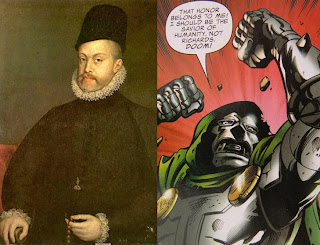
Philip II and Victor von Doom


In issues 551 through 553 of The Fantastic Four, the FF get a surprise visit from a future version of their oldest nemesis: Victor von Doom, aka Doctor Doom. Doom has traveled back in time on a purportedly benevolent mission: to warn the team that Reed Richards will go mad with power, and that this will have disastrous consequences for the entire planet. Under normal circumstances the FF wouldn't believe Doom for a second, but they've recently been shaken to their foundations by the events of the Marvel Universe's Civil War, in which Reed made some choices that caused most of the world to lose faith in him. They listen to what Doom has to say, more or less, and then a time portal opens and their future selves - the FF from the future Doom's timeline - show up. They want to take Doom back with them, but the present-day Reed, allowing for the possibility that what Doom says is true, decides to protect Doom. Arguments - and eventually fighting - ensue between "our" FF and their future selves: not simply because the future FF want Doom, but because they remember a version of history where they fought their future selves, and this is all part of preserving the time stream! Eventually the fighting subsides as the present-day FF learn the truth. Here's the conversation between Ben Grimm, the future Doom, Sue Richards, and the future Reed Richards.

Ben:
You guys are tryin' to keep things the way they were, but Doomsie... is trying ta change history.


Doom:
As I said. To prevent Reed's madness from destroying the future.


Sue:
Destroying it how, Victor? You say you're a man of honor... tell us the truth. What's the world like where you come from?


Doom:
...
Paradise.
It's paradise.
His dual-layer Dyson swarm provides nearly free and inexhaustible energy. Advances in medicine have greatly extended both the duration and quality of life. There hasn't been a war in over 40 years, hunger and crime are all but unknown, education is universal. Art thrives.


Reed:
There's still a lot of work to do, but --


Doom:
But humanity is safe, happy, prosperous and striving for true greatness.
And it's all Richards's fault.


Ben:
Fault? Are you out of yer blamed mind?


Doom:
That honor belongs to me! I should be the savior of humanity, not Richards. Doom!


Reed:
Now you know the truth. Doom came back to the past, intending to correct history so that the future would be the product of his hand.


Fun story, huh? Well, I sure enjoyed it. But it's not just a story.


In 1571 a Christian naval coalition defeated a large Ottoman force at the Battle of Lepanto. The unprecedented cooperation between Western Christian states shows how dire the Ottoman threat had become. Had the battle gone slightly differently, the Christian forces would have been enveloped by the larger Ottoman force and crushed, leaving the eastern Mediterranean and much of eastern Europe open to further encroachment. One would think that any Christian would have felt unalloyed joy at news of the victory, let alone the king of one of the main countries involved. In my experience, though, you can always count on Philip II to behave enigmatically. First, let's put Philip's Catholic faith into perspective. The following is from page 27 of David Howarth's The Voyage of the Armada: The Spanish Story.
But it was not only a political empire; it was also a religious entity, and that was what made it so complex. King Philip was His Most Catholic Majesty. He believed he was appointed by god to defend the truth against infidels and heretics. The pope was Vicar of Christ: Philip, in his own eyes, was Champion of god, the equal of the pope in God's designs. In this sense, his boundaries were vague. There were people all over Europe, caught in the ebb and flow of Reformation and Counter-Reformation, whose loyalties were divided between their country and their church. In almost all of Philip's Catholic domains, Protestants had been exterminated, or pushed far under ground, by the Inquisition. The only exception was the Netherlands. All through his reign they had been in revolt, partly against the shame of foreign rule and partly to protect their Protestant creed: he had to keep an immensely expensive army there, and it had never succeeded in putting the rebels down. But he was not only concerned with his own domains. It was his personal duty, divinely imposed as he believed, to punish Protestants everywhere and rescue Catholics who lived under Protestant rule.
Now, on to Philip's reaction to Lepanto in 1571. The following is from page 294 of Victory of the West by Niccolo Capponi.
Despite his apparent elation over the Christian victory, the king was not totally happy about the league's success. Don Juan had put the Habsburg galleys and soldiers at considerable risk by deciding to join battle - a rash decision to say the least, especially for el rey prudente, and according to a number of Philip's councillors the prince could only thank God if he had come out of it alive. Significantly, the king commissioned only one work of art to commemorate the victory - Titian's Philip II, after the victory of Lepanto, offers the prince Don Fernando to victory, now in the Prado - and to celebrate more the continuity of the Habsburg line than the Ottoman defeat. The six large canvases of the battle by Luca Cambiaso, now in the Escorial, were probably gifts of Giovanni Andrea Doria to the royal secretary Antonio Pérez, acquired by the king at a later date. One has the distinct impression that for Philip the league victory represented a potential source of political trouble, possibly because by weakening the Porte's navy it had altered the balance of power in the Mediterranean and loosened Spain's grip on Italy.
This utterly amazed me when I first read it, and it still makes my jaw slacken a bit. Philip II was the model of a Catholic King of the sixteenth century: as relentless as he was devout. Yet upon hearing of the greatest Catholic victory of his age, his reaction was lukewarm. It didn't matter to him that Christian forces won, as long as he wasn't in control. Even if everything happened that he wanted to happen, it didn't matter as long as it wasn't by his hand. Sound familiar?

The best stories aren't just stories. They're history.

Thanks to Grace for giving me the idea for this entry. It still amazes me that I didn't think of it, seeing as how I was the one who told her about this aspect of Philip's personality.

Well isn't that Special?


So the other morning, on my way to the shower, I was thinking about the Duke of Medina Sidonia and George Washington. OK, that sounded a tad slashy, didn't it? Don't worry, though: I strive to make history exciting, but not that exciting.

...

Psst! You're supposed to say "So, uh... why were you thinking about Medina Sidonia, the commander of the Spanish Armada of 1588, and George Washington, the Commander-in-Chief of the Continental Army from 1775 to 1783 and first President of the United States?"

I'm glad you asked that question! And in such a fine, expository manner, too! Why, I think of the two men often because, odd as this may sound, I'm struck by their similarities: as a nobleman experienced in administering large estates, each was one of the very few men of his time qualified to command large-scale logistical operations; each had the ability to draw upon the resources of his homeland, a vast region whose participation in the coming conflict was absolutely crucial; and each was reduced at several times to writing desperate letters to other commanders who were supposed to be giving him support, but who instead decided not to associate themselves with one who looks to be the loser. There are more similarities, but this is all a story for a future entry.

As I was heading into the shower (again with the inspirations coming to me in the bathroom!) I was thinking of all this, and of how I should blog about it soon, and how I should also do entries about the similarities between Philip II and Henry VIII, and so on. Then a memory surfaced...

As Hugh steps into the shower, we zoom with a reverse dolly so that the background retreats. Insert reverse aging SFX so that Hugh is now 22 years younger. When we dolly in and zoom out, Hugh is standing in a hallway in his high school, looking on as Bob signs Hugh's yearbook.

In 1986, my sophomore year, Bob Cole was the salutatorian of his graduating class. He also played first trumpet in stage band. I played third trumpet, so I knew him about as well as a tremendously geeky sophomore could know an exceedingly together senior. He was a nice young man, and I'll bet he went on to become an outstanding member of his community. At the time of his graduation, though, he mostly just annoyed me. See, my friend Tony and I were totally into our own geeky little world, constantly quoting from whatever science fiction or advanced calculus or crude comedy routine we were into at the moment. Once or twice Bob expressed his irritation at this, saying that I should be bettering myself by reading biographies instead of wasting my time with these fictional worlds. He alluded to this in what he wrote in my yearbook. Now, to be fair, he wrote a lot and most of it was quite nice. The closing sentences were what annoyed me.
Fiction is interesting, but fact is where it's at. Remember also that you'll sleep one third of your life away. So don't waste time! Take care.

Bob Cole


Dick. That's what I thought at the time, and I stand by it. Now, don't get me wrong; we were high-schoolers, and all high-schoolers are dicks in some way or another, so it's absolutely no insult to Bob. Also, Bob was right: I should have been reading biographies. I wish I had been reading biographies. The ignorance I felt two decades later that motivated me to start learning history was a direct result of disregarding Bob's words. But Bob was wrong, too, and here's why: You don't get anywhere with people by preaching. Right or wrong, if you point out a person's deficiencies and tell them what they should be doing, it just ain't gonna work out well. And anyway, it's usually more about the ego of the one giving the advice than about the well-being of the one getting it. Regardless of all that, though, people simply don't take kindly to being told what to do. I want to go back to that moment and whisper in Bob's ear: Bob, don't tell him what to do. Not only is that not gonna work, it's gonna piss him off. If you want him to read history... tell him a story. Tell him a story about a king kneeling in a tiny room - a king who had the power to assemble the greatest Armada the world had ever seen, and hurl it across the ocean at his most bothersome foe, but who never stepped outside that room to meet his commanders, or to observe his vast armies, or to lay his hand on the prow of one of his mighty ships.

When I thought of all this - of how Bob was 100% correct in what he said but 100% wrong in his approach - something crystallized in my head, and I came up with another Law of The Pond Seeker. Now I have three of them, in descending order of priority, like with Asimov's Three Laws of Robotics.

  1. Learn.
  2. Share my enthusiasm.
  3. Don't preach. Do tell stories.

So I ain't gonna preach to ya. I'm gonna tell ya stories. If I do my job right, the rest will come on its own.

Next time: The story of that king.

Wednesday, February 27, 2008

So... Why Maps?


You wouldn't think that eighth century Byzantine economics could inspire a guy. The thing about the Muse, though, is that she has no regard for what you or I think. That's exactly as it should be; I believe in waiting humbly for the Muse, and being nothing but grateful if she deigns to swing by. And I believe that the most profound expression of my gratitude is to grab her mane and ride her for all she's worth. I don't ask questions about her destination, and she doesn't ask questions about my mixed metaphors.

A few weeks ago during a morning commute I was listening to Professor Kenneth W. Harl lecture about the ways in which Constantine V stimulated the Byzantine economy. Constantine forcibly imported artisans from around the empire to engage in large building projects in Constantinople. This greatly stimulated the economy by increasing taxes and the exchange of coined money. Constantinople was also the home of state monopolies such as the silk trade. Ho hum. Then Professor Harl got to a good bit about how, back in the days of Justinian, some Nestorian monks had smuggled silk worms out of India in their bamboo rods, and from those stolen worms arose the silk industry that spanned southern Greece, the area now known as the Peloponnese. In Constantine's time, though, it was known as Moria.

Wait. Pause. Rewind. What? Moria?? As in the Mines of Moria from The Lord of the Rings? Well, OK, Wikipedia says it's actually Morea, with an E. Still, it made me wonder about the possible associations as I digested Professor Harl's news that Morea means "mulberry", the tree on which the silkworm does its thing. Constantinople sold silk to Western Europe at a huge profit, so it stands to reason that this region, from which so much Byzantine wealth arose, was named after the plant that made it all possible. The Wikipedia article, though, indicates that the origin of the name is not quite as cut and dried as all that:
There is some uncertainty over the origin of the name "Morea", which is first recorded in the 10th century in Byzantine chronicles. As with many other things in the Balkans, part of the uncertainty stems from the political implications behind each suggested origin of the name.

Popular belief in Greece today is that the name originates from the word moria, meaning mulberry, a common plant in the region. In Greece it is also believed that it is of Frankish origin.

In 1830, the Austrian historian Jakob Philipp Fallmerayer (1790–1861) published the first of his volumes Geschichte der Halbinsel Morea während des Mittelalters ("History of the Morea Peninsula during the Middle Ages"). Based on his analysis of the spread of Slavic place names in mainland Greece, Fallmerayer proposed that the 19th century Greeks had almost no linear cultural connection to the ancients but a large one to the Slavic tribes who had invaded during the 6th and 7th centuries. To support his thesis, Fallmerayer proposed that the word comes from the Slavic word more, meaning sea. Fallmerayer did not find any conclusive evidence as there was no evidence other than several scattered village names to suggest this. The spelling of the name with the omega "Ω" however indicates that the word is likely of Greek origin with the omega being a prolonged "o" sound.
Now that's interesting, and a much more likely origin of the purportedly magnificent abode of Tolkien's Dwarfs; after all, I can certainly see Gimli as a Slavic warrior.

I ruminated on the Tolkien connection as I walked to work. As I went into the bathroom - and isn't it weird how often inspiration hits in the bathroom? - a thought struck me, apropos of nothing but the fact that I happened to be thinking of maps and Tolkien: He put maps in his books, but no other illustrations! That means something! Maps are so important that Tolkien chose them above all other images to include in his printed work.

Turns out I was totally full of crap. It just so happens that I've only read the relatively cheap editions of his books that have no illustrations except maps. There are other editions with Tolkien's drawings of characters and landscapes. In order to acquaint myself with what Tolkien actually drew, as opposed to what I had fancied he drew, I got three books out of my library : The Annotated Hobbit; J.R.R. Tolkien: Artist and Illustrator; and Pictures by J. R. R. Tolkien. They show that Tolkien was quite engaged in drawing his characters and their villages and houses, not to mention many colorful patterns that are reminiscent of Medieval manuscript illuminations. So I was wrong. But then again, perhaps I wasn't entirely wrong. Because even though Tolkien did draw things aside from maps, his drawings of maps seem different than the rest. Unlike the ethereal feeling I get from the other material, the maps seem very solid and real. And then there's the simple fact that there are editions with only maps. Someone thought that it was important to leave the maps in even when all else was stripped out.

But that's not the story.

The story is that I wanted to believe that Tolkien thought maps were special. The only basis I had for this assertion was the single edition I'd read, yet I got excited enough about this "discovery" to become rather crestfallen when I found out otherwise. Once I recognized this desire, it became clear that I think maps are magical, and that I was searching for a way to articulate and justify the fascination that had taken hold of me so abruptly and so thoroughly. The more I thought of it, the more sense it made, because maps are magical. Maps do something that the human brain - especially my brain - can't do, or at least can't do well. Maps show complex spatial relationships, and we're so used to them that we forget how difficult such relationships are to visualize without them. Look at Matthew Paris's map of the pilgrimage route from London to Apulia. Essentially a one-dimensional construct, the map shows simply that the path from this abbey leads to that abbey, and that path from that abbey leads to this mountain, and so on. There are virtually no two-dimensional relationships. This map reveals that visualizing two-dimensional - let alone three-dimensional! - relationships is something that the human brain just doesn't do out of the box. It has to be trained to do it! Maps represent not only a way to help with that training, but a shortcut around it!

Military historians talk a lot about castles and fortresses as examples of force multipliers. The notion is fairly straightforward: there are ways of multiplying the effective force of a few people so that they seem like a lot of people. This usually involves paying a premium to gravity so that you can reap huge dividends later. You get together a bunch of people who, over a long period of time, lift stones from low places and build a particular kind of very high place out of them. Once they're done assembling that high place, they bring themselves, and lots of food and weapons, into it. Now, anyone who wants to get to the people, or the food, or the high place itself, have to fight their way to it from the bottom of the enormous potential well created by all that work. And the people up there who did the work? They have the option to release most of that energy they stored up over the months and years, very quickly: all they have to do is drop things. I said the notion is straightforward. The sheer (ha ha) effectiveness of the force multiplier, though, beggars the imagination if you're hearing the actual numbers for the first time. I know I was absolutely stunned last year when I read the bit in Niccolo Capponi's Victory of the West about the Siege of Malta in 1565. The Ottomans landed on Malta in May with about thiry five thousand men and nearly sixty guns, some of them huge masonry destroyers. Thirty five thousand men! That's more than the Armada carried twenty-three years later! What was even more surprising to me, though, was that Malta - with less than six hundred members of the Knights Hospitaller, four hundred Spanish troops, around four or five thousand Maltese, and fifty artillery pieces - held out against this force until Sicily came to the rescue in September!

Here's what I'm coming to realize: Maps are intellectual force multipliers. When you make a map, you take huge amounts of work done over vast periods of time and you bundle it together. Just consider the amount of work that al-Idrisi did in making his world map. That piece of paper with the continents isn't just a piece of paper: it's a highly-concentrated chunk of negentropy, or order. The waste heat discharged from all that gradual work done over all those centuries to bring together the knowledge distilled into the map hanging on my wall could incinerate the world's armies. And with that energy people can take their brains - which may be ill-suited to the task of visualizing what the map shows, and anyway probably don't have the time, resources or inclination to go across the ocean to find out for themselves what's there - and they can make decisions that change the world. That concentration of power in an unassuming form is, I think, what makes maps so fascinating to me.

Tuesday, February 26, 2008

The Sixteenth Century: Now with 30% more Confessionalism!


The recent In Our Time episode about Rudolf II got me to thinkin'. I made some connections that pretty near blew my mind - yeah, I know, it doesn't take much - and now I feel like I understand the sixteenth century a little better. You be the judge. Here's a transcript of the relevant bits; I gave up on sorting out the voices, so all three of the guests are just listed as "Guest". Their names are listed on the site.
Bragg: There was a university in Prague... there were universities all across Europe, yet Rudolf was attracting these people. What was he offering - his course - that the universities weren't providing?

Guest: Well, Charles University in Prague is a special case because in the aftermath of the Hussite Revolt Prague had been sort of sealed off from the rest of Europe and not fully integrated, so it was in a bad state. But the more general point is that universities were set up effectively to teach the received heritage of the west and to pass it on to the next generation. They were not remotely regarded as research institutes; they weren't set up, they weren't founded, they weren't funded for that kind of thing, and if you wanted funding - salary in the first instance, equipment and assistance in the second, to pursue natural philosophical inquiry, and to move back the frontiers of knowledge to change the accepted order of things, and you were not very independently wealthy as of course Tycho Brahe was, you needed to find a wealthy patron to sustain at least some part of that inquiry. And the obvious concentrations of wealth and prestige were in the courts of Europe - central Europe of course was divided into many individual territorial principalities, so it was very rich with this particular resource. Rudolph was at the summit of that system: notionally for the whole of Europe, and certainly for central Europe. And the other part of the equation is of course that it began to dawn on rulers in the Renaissance period that there was considerable prestige to be attached from being associated with these collections, with the kind of concentrations of knowledge and expertise, and also conceivably with the discoveries, whether mathematical, astrological, or whatever. So there was an incentive for them to patronize scientists - what we would call today scientists on the one hand, alongside artists on the other.

Bragg: He spent some of his youth at the court in Spain...

Guest: Yes, that's right, and that was the main thing he brought back with him. I mean, what he didn't bring back - and this is crucially important for understanding the natural philosphical as well as other aspects of his reign, is the ethos of the Counter-Reformation. Because there was simply no way of translating that from the Spanish half of the Habsburg family to the Austria half, because the political conditions were utterly different. He didn't have a consolidated state like Castile to make the center of his empire, he didn't have the ethos of the Reconquista, five hundred years of expelling first the Moors and then the Jews from the Iberian Peninsula, and of course he didn't have the boatloads of gold and silver coming in from the New World, either, to finance a military campaign, nor did he have the army. So he needed to find a way out of this trap which was building all around him, of his empire dissolving into equally antagonistic confessional factions. And part of the reason he then ends up patronizing this remarkable work in the arts - broadly conceived - including the arts of alchemy and astronomy, shifting into an interest in the natural world, is because here we have a field of cultural significance and creativity outside this fractious confessional demesne. So he's actually responding very creatively to the confessional pressures of the era by shifting the center of gravity of his court in a rather different (one or two of the other guests say "Yeah" in agreement) Now that doesn't tell you his personality, but given that he has a reputation, particularly in his latter years, of actually going mad, of actually sort of losing his grip, this suggests to me a very visionary and a very creative response to an almost impossible situation, one which had been prepared by previous Habsburg emperors, particularly his father Maximilian II, which Rudolf epitomizes and pushes to a new level because it is the only way of escaping from this dilemma that he finds himself in.

Bragg: Anything to add about his character before we wrap on him?

Guest: Yeah, I mean maybe I'm being slightly facile here, but Rudolph's father had a reputation for being extremely liberal, hence you've got this development of the Ultraquists - the believers who tolerate both confessions, Protestant and Catholic. Maybe Rudolph is more that he can't stand either confession particularly, so he doesn't favor either, which gets him into a lot of trouble of course with the church.

Bragg: Well he is, as we said at the beginning of the program, he is trying to get God out of the equation, isn't he?

Guest: He's trying to get the Catholic interpretation of God, perhaps, out of the equation, but there's no doubt that he's attracting people that are extremely devout, extremely spiritual, but they're performing practices that orthodoxy will automatically condemn as being diabolic.


I found the notion of Rudolf actively seeking to balance out the Counter-Reformation with a liberal alternative to be immensely intriguing, and a little suspicious: it had that whiff of twentieth-century thinking about it, so I wondered if there was actual historical evidence that Rudolf thought this way, or if the contributors were stroking a pet notion to the point of distortion, as historians sometimes do. I was thinking of posing this question to the Gunroom and, always keen to put in a Patrick O'Brian connection, I began thinking of Stephen Maturin. Of all the characters in 'the canon', Stephen is the only one who comes across to me as surprisingly modern. The following comes from a conversation in Master and Commander between Stephen and James Dillon, referring to their involvement in the Irish Rebellion of 1798.
'...Even then I no longer cared for any cause or any theory of government on earth; I would not have lifted a finger for any nation's independence, fancied or real; and yet I had to reason with as much ardour as though I were filled with the same enthusiasm as in the first days of the Revolution, when we were all overflowing with virtue and love.'

'Why? Why did you have to speak so?'

'Because I had to convince him that his plans were disastrously foolish, that they were known to the Castle and that he was surrounded by traitors and informers. I reasoned as closely and cogently as ever I could - better than ever I thought I could - and he did not follow me at all. His attention wandered. "Look," says he, "there's a redbreast in that yew by the path." All he knew was that I was opposed to him, so he closed his mind; if, indeed, he was capable of following me, which perhaps he was not. Poor Edward! Straight as a rush; and so many of them around him were as crooked as men can well be - Reynolds, Corrigan, Davis... Oh, it was pitiful.'

'And would you indeed not lift a finger, even for the moderate aims?'

'I would not. With the revolution in France gone to pure loss I was already chilled beyond expression. And now, with what I saw in '98, on both sides, the wicked folly and the wicked brute cruelty, I have had such a sickening of men in masses, and of causes, that I would not cross this room to reform parliament or prevent the union or to bring about the millennium. I speak only for myself, mind - it is my own truth alone - but man as part of a movement or a crowd is indifferent to me. He is inhuman. And I have nothing to do with nations, or nationalism. The only feelings I have - for what they are - are for men as individuals; my loyalties, such as they may be, are to private persons alone.'

'Patriotism will not do?'

'My dear creature, I have done with all debate. But you know as well as I, patriotism is a word; and one that generally comes to mean either my country, right or wrong, which is infamous, or my country is always right, which is imbecile.'
I always thought this sounded a lot like twentieth century nihilism. Yet the Gunroom folks, who know a thousand times more about Patrick O'Brian than I ever will, swear by his ability to "inhabit" the period; it's supposedly almost impossible to catch him in an anachronism. So I had to concede that if my reaction to Stephen was wrong, then my reaction to Rudolf might well be wrong too: perhaps what I perceived as a twentieth-century motivation is actually a universal human motivation. Amid all this angst over the appropriateness of bringing modern interpretations to bear on non-modern characters, I thought of the similar, stronger reaction I had when I read the placard for the Cimerlini cordiform heart map at the Field Museum. It said that "At a time when the world was divided by religious conflicts, some mapmakers thought that it was important to portray a world unified by love and tolerance." At the time, I took umbrage at what seemed to me like a wrong-headed interpretation, only to find out later that the writer of that placard was easily one of the world's experts on Cimerlini and his contemporaries, and on their motivations. I couldn't have been more wrong if I'd tried. While I was thinking of all this, something went click and a big piece of the puzzle that is the sixteenth century fell into my lap: It's all about confessionalism.

In 1517 a man walked up to a wooden door and nailed a piece of paper to it. That it happened to be a church door, and that it's seen as the spark that ignited the Protestant Reformation, has led people to think of this act as one of rebellion. It wasn't. It was the equivalent of you or I going down to our local city hall and filing a complaint. It was only after the Catholic Church and Luther had gone through a few rounds of "Shut up!" "No, you shut up!" that Luther truly became a revolutionary. In other words, times were overripe for religious discord. During the next few decades, confessionalism reached awe-inspiring proportions as Protestants split with Catholics, and then Protestantism itself became so splintered that one has to laugh or cry at the seemingly endless ramification.

In 1566, in the midst of this divisiveness, a man made a heart-shaped map of the world as a way of saying "We are all one."

Toward the end of the sixteenth century, a man looked at all the splintering - of credos and of skulls - going on around him; in an attempt to change the subject, he gathered wizards from all over the land to show the world shiny new things.

Now let's go back to 1588, to a man in a small room, clutching his well-worn rosary beads and trying to ignore the pain in his knees. I've often wondered about that man. Philip II had power the likes of which is quite simply inconceivable. He ruled an empire that reached from the Philippines in the east to South America in the west. He set in motion the greatest armada the world had ever seen. Few dared tell him that his plan for that armada was logistically impossible. Medina Sidonia tried to do so several times, at no small risk to himself, but Philip's councilors of state refused even to pass the last letter along.

Why? What makes humans think it's a Good Idea to give their power to kings? I still feel like I'm light years away from being able to answer that question, but at least now I feel like I understand Philip II in the context of his times a little better. The tendency toward confessionalism was extremely high: people were desperate to define themselves as Catholic or Protestant or Calvinist or Followers of the Great Green Arkleseizure, and then to set themselves against the Other. In this atmosphere, of course people gave their power to a man who could not bear the thought of a single Protestant in all of his vast kingdoms - a man willing to drain the Spanish treasury trying to expunge every last one. Just as today, though, there were people like Cimerlini and Rudolf who reacted to that oppressive divisiveness by trying to bring people together. Philip's power flowed from religion, and the engine of religion ran on a confessionalist gradient. Rudolf was marketing a new kind of engine.

People tend to look upon the sixteenth century as a conflict between confessional factions. Now I see those wars of religion as a subset of a larger conflict between divisiveness and unification. I'm pleased to have reached this new perspective by honing an old tool: Ever since I listened to Professor Brad S. Gregory emphasize the importance of viewing historical characters from within their own context, I've striven never to see history through modern lenses. That mindset has come in uncommon useful when reading about people from Elizabeth I to George Washington. Moments like this, however, make it clear that I've gone overboard. Certainly it's not useful to clutch stubbornly at those modern lenses when there's an old, dusty pair with a more appropriate focal length available; but neither is it useful to reject out of hand anything that sounds modern. After all, I believe firmly that people are people, and that in the most general sense human motivations don't change. I'm dead certain that I would have much more to talk about over a beer with Samuel Pepys than I would with the vast majority of my own peers.

The picture on the top right is of Gustav Mahler. I used it as a stand-in for the fictional Stephen Maturin because Mahler is, to me, the very image of Stephen. Look through some pictures of Mahler and you'll see how hunched he looks, how uncomfortable he seems in his own skin. That's Stephen for you.

Sunday, February 24, 2008

Tangent... or boomerang?


Yesterday I had another one of those lovely moments when a search looped back on itself. They seem to be happening more often; hopefully this means that I'm developing that framework for understanding that I wrote about the other day.

I figured I'd had enough of a breather after my marathon writeup of the Field Museum exhibit, so I tackled my notes from the "Virtual Tourist in Renaissance Rome" exhibit at the University of Chicago Library Special Collections Research Center. I began transcribing them, but soon I ran up against another tangent I just knew I'd end up chasing: the fascinating symbols in the frontispiece of Bartolomeo Marliano's guide to ancient Rome, Topographia antiquae Romae, published in Lyon by Sebastien Gryphius in 1534. The gryphon, the rectangular block, the chain and the winged sphere fascinated me so that I took the time to draw it in my notes. Thankfully you don't have to make do with my sketch. The top left section of the picture above shows you exactly what I saw. Click it to see a larger version.

My fascination with these symbols started a conflict in my brain. "Why do you care about this?" I asked myself. "It's just a symbol that some publisher hoped would impress folk. Keep pushing ahead! Don't get lost in minutiae like you always do!" But I knew it was useless; I had my teeth in those symbols, and I wasn't about to let go.

I did some unsuccessful Googling, and then hit the jackpot. Holbein's Ambassadors, a book by Mary S.F. Hervey that's fully downloadable from Google Books, has an image almost exactly like the one above, and the following explanation.
The sixteenth century repeated its favourite symbols over and over again. Alciati had made famous that form of emblem in which words and picture combine to form a single device. But in so doing he had merely given classical shape to a general taste. the better-known symbols were so familiar that they were readily understood without the explanatory text. Such was that adopted by the bishop of Auxerre in the window of the Maison de l'Aumonier.

The sphere with the wings of Hermes is an emblem appropriated by Fortune. Sometimes a youth, sometimes a maiden, with winged feet lightly poised on an ever-rolling globe, or wheel, the figure of the deity was well known and popular in the sixteenth century. Derived from the antique, it had quickly leaped into favour on the revival of learning. there were many variations of the familiar allegory. Machiavelli had devoted a sonnet to it; Alciati had placed it among his emblems; it had been painted and carved, and all were acquainted with the symbols that gave it pictorial expression. When, therefore, the winged globe was abstracted from the whole subject and used as a separate emblem it was readily interpreted. But to guard against all possibility of misunderstanding, the printer Gryphius has added to the symbol the motto, Virtute Duce, Comite Fortuna [Virtue as guide, Fortune as companion]. The meaning is identical with that of the Dinteville motto and conclusively proves the point.
The wings of Hermes! OK, so the image was appropriated as the new symbol of Fortune. Fortuna ain't quite a god, but heck, she's close enough as makes no odds; I sure don't want to mess with her! The point is that those early publishers really did think of themselves as the new gods! Immediately this connected back to the van den Keere world map of 1611. Take a look at the largest of the three images above. Of all the allegorical tableau from that map, that's the one which fascinated me the most. See how Death is wrestling with a man for control of an hourglass? That's not just any man. See the apparatus near his feet that's labeled "DE WITTE PAES"? That's a printing press, and the label means "The White Press", the printing shop in the center of Amsterdam where the map was made. That man is a printer, and as far as I can see, he's on a roughly equal footing with Death! The way I read this, the printer sees his craft as giving mankind the godlike power to impede Death; able to store and disseminate information in ways that were impossible mere decades earlier, man can effectively slow the deleterious effects of time by passing his essence to posterity! Gryphius thinks of himself as a modern day Hermes, and van den Keere is ready to rassle with Death!

Intriguingly, that wasn't the only connection to the van den Keere map. Hervey's book is about a specific painting: The Ambassadors by Hans Holbein. YIKES! I think this is what the young kids nowadays are calling "freaky-deaky". Until I read the article I had no idea that anamorphic perspective was an invention of the Early Renaissance - or even what anamorphic perspective was. That is an amazing painting, one that I'll be spending some time analyzing. For now, though, it's enough for me to ponder what these images say about their makers. These symbols speak of people deeply invested in establishing a cosmology, yet unable to find their own place in it: "Look at our new tools! We've mapped the world, and our knowledge flies to its four corners! Surely we are the new gods! Aren't we? Aren't we? ... By the way, tell that skinny guy with the hood and the scythe to stop staring at me."

When I read history I get scared easily. It ain't a matter of taking the road less traveled by, because the road in the yellow wood branches off not into two, but into a seeming infinitude of paths. I cringe at all I'll never have time to learn. I think that's why I have a tendency to focus so obsessively on minutiae like this; if I bring my entire sensorium to bear on a square millimeter of the surface of history, it blocks out the vertiginous view of all I don't know. It's very easy to fill my mind's eye with one man and his printing press - to wonder why he thought it was a Good Idea to take a wooden block with those particular symbols, put some ink on it, and press it to paper. It's a lot easier than attempting to get my head around the vast sweep of history going on around that man. The disadvantages are obvious: after all, the whole point of me studying history is to understand that vast sweep, and here I am wasting precious time on trivialities. This time, though, it worked out well. Gryphius's frontispiece led me down unexpected paths, and now I'm thinking back to my lectures about Erasmus and wondering just how much his humanist teachings affected that printer in Lyon. Sometimes those minutiae I chase because they're comfortable turn into windows, and I find myself looking out at an expanse I'd been scared to face before. And you know what? The sun feels kinda good on my face.

With apologies to Samuel Pepys


23rd. Up betimes and to the woods, where walked up and down a short while with much content. Thence home a while to look after my blog; and to Whole Foods, where the doors were not then open; but presently they did open; and I in, and bought a bagel for 79¢ and went home again, where I ate it with some eggs to my breakfast. But Lord! To think of the many thousands of eggs I have eat since I was a boy, and yet upon the eating of every new egg I find it to be the pleasantest in all respects that ever I had in my life! I by train under the river to Penn Station (all the way reading in Wikipedia of the Hussite revolt), where great crowding of people that had a desire to get up stairs. But then it shews them fools, that they would not walk to the farther stairs, which they might all have gone up faster. Thence to the New York Public Library to look upon a book about van den Keere (a Dutchman, that made a great map of the world in the year 1611), wherein I saw most incomparable pictures. So away, and did happen upon the most perfect pair of stockings for my Lady Watson, they being of a pattern very pretty and mirthful, with little black dogs on a field of green. I did buy them, and the other stockings together with them, for seven dollars, and was well pleased with them and the price. Taking up my wife, went homewards, and so to Sakura, there to meet my Lady Watson and Sir M. Castle, where we were very merry, and a mighty pretty dinner of sushi rolls we had, and much discourse. I did give my Lady Watson the stockings, which pleased her, and she did give to my wife a fine picture of her cat put within a frame, that pleased her mightily. And so we home, and I gave my Lady Watson some books for her to read of the life of Henry VIII. And so they left us, and I to my blog and my wife to her studying. And so to bed, where we lay a while, I rubbing my wife's feet, and we very merry.

Saturday, February 23, 2008

A new release of Mattingly's Armada!


Tell everyone! Prepare the hearth! Slaughter the fatted calf! Let all the church bells ring! O wonderful, wonderful, and most wonderful wonderful! and yet again wonderful! and after that, out of all whooping!

I sense that you do not share my excitement. Can it be you are unaware of Garrett Mattingly's masterpiece? Have you not surrendered yourself to the warp and weft of his narrative, not wondered at how one man could be both meticulous historian and storyteller born?

Well... dude!... whaddaya waitin' for??

Last night, while writing the previous entry, I noticed that a new hardcover edition of The Armada is scheduled for release just a few days from now. Cool!!! The previous edition of 2005 was a paperback. Aside from this fancy edition of 2002, it seems that there hasn't been a hardcover edition in quite a while. And at only ten bucks, this new one is a steal. So buy one!* Buy ten! You buy me one, I'll buy you one, and we'll both give 'em away to some lucky, lucky reader. And if you've already read your Mattingly, then why not work your way down the following reading list? Believe me, it won't get boring: the more I've read about Philip II, the more fascinatingly inscrutable he becomes.**

  • The Spanish Armada by Martin and Parker: Among other things, their modern research on the Armada gunnery and their character analysis of Philip II are welcome additions to the literature.
  • The Great Enterprise, ed. Stephen Usherwood: An excellent collection of period documents that shed a great deal of light on the Armada.
  • The Voyage of the Armada - the Spanish Story by David Howarth: A very valuable and criminally overlooked addition to the literature. Howarth will give you more insight into the nautical mechanics of the Armada than you ever knew you needed.
  • The Spanish Armada: The Experience of War in 1588 by Felipe Fernandez-Armesto: I was only 64 pages into this one when, on December 26, I got bitten by the cartography bug. I'd read enough, though, to say with certainty that it adds a new and entirely necessary dimension to the Armada story: the experience of the common soldiery and populace on both the Spanish and English sides. It starts out with Miguel Cervantes doing his duty as an Andalusian procurement official for King Philip during the intensive Armada preparations - and getting excommunicated for his troubles!
  • The Appointment of the Duke of Medina Sidonia to the Command of the Spanish Armada, an article by I.A.A. Thomson of the University of Keele in The Historical Journal, XII, 2 (1969), pp. 197-216: This brilliant article deconstructs the usual straw man approach to Medina Sidonia, showing why he was not only the right man, but perhaps the only man, for the job. If you don't have access to JSTOR then beg, borrow, or steal it. NOW!
  • The Victory of the West: The Great Christian-Muslim Clash at the Battle of Lepanto by Niccolo Capponi: a densely detailed yet surprisingly engaging account of the Battle of Lepanto in 1571, and the preposterously convoluted politics leading up to it.

*I highly recommend the 1959 hardcover version, regularly available from Amazon resellers for a buck or less plus shipping. If you can't afford one, I will send you one. I am serious. I buy copies specifically to give them away.

**I remain hopeful that someday I'll scrut him.

Friday, February 22, 2008

It ain't quite the light on the road to Damascus, but it'll do.


In December I had two watershed moments in quick succession, and I think they represented my first steps beyond a sort of event horizon. Today I realized that I'd only recounted one of them. This is the other. To set it up, I need to go back a ways.

A few years ago I took a hard look at my own ignorance and resolved to make myself less so by reading only history. This was very difficult, since I'd never liked history and never had a head for it; my attention span wasn't the greatest and my retention was abysmal. At first, my progress felt like slogging uphill through molasses. Then I read The Armada by Garrett Mattingly, and the scales fell from my eyes. It was the first time I had ever enjoyed reading a history book - the first time I even realized that it was possible for history to be exciting. In the midst of this wonder and exhilaration I was also frustrated: that I hadn't found this out twenty years earlier, and that despite my excitement I was still moving through the book at a snail's pace. Ah, but the reason for that snail's pace gave me still more cause for exhilaration: I was stopping every few sentences, and sometimes several times per sentence, to look up all the things I didn't know; and for the first time in my life, I was enjoying it so much that I didn't mind! Mattingly's book is a model of meticulous history, yet it's also the most captivating story I've ever heard. He gave me a precious gift: the knowledge that there are ways of looking at history that make it exciting.

I finished The Armada in May of 2006, and during the next eighteen months I discovered more ways to make history exciting. David Hackett Fischer's Washington's Crossing was a high point; it taught me a few things about historiography that I'll be talking about in future entries. I read several more books about the early days of the American Revolution, and several more about the Spanish Armada, growing more fascinated by the world of Philip II with each one. During my hikes and my commute I listened to many Teaching Company lectures on my mp3 player. I started to feel like I actually knew a thing or two. Yet I also felt like I could never make up for lost time, or for my lousy attention span and retention: what I didn't know was so vast that whenever I learned something new, I had nothing to connect it to. Soon it would fall out of sight, swallowed up by the deep shadows in my miles-wide chasm of ignorance.

Then in December I felt something new happen in my head. I had been going back and forth through the 12 Byzantine Rulers podcasts. They're good, but since they're so detailed, and since I had so little knowledge of the period, I had literally listened to some episodes around six times in order to take everything in. Again, I was frustrated, feeling like I hadn't even achieved a mental framework on which to hang anything, let alone a robust structure! But then one morning I felt a framework being built. I was listening to the episode on Irene, an empress who presided over a particularly disastrous era for the Byzantine Empire in the eighth century. The iconoclastic controversy distracted the empire from the Muslim threat that was whittling away its periphery. In the midst of this, Pope Leo got so fed up with receiving absolutely no support from Constantinople for Italy's fight against the Lombards that he finally went to France for help! That's why Charlemagne got in bed with the Papacy, it's how the Papal States got created, and it's what directly preceded the unprecedented crowning of Charlemagne by Leo in 800! Well, anyway, here I am swimming in the wide-open space and struggling to remember all this stuff, and all of a sudden my ears perk up. "Hey, Charlemagne! I had been struggling to remember what I knew of him..." and I felt the two whisper-thin filaments of understanding connect, and there was a TZZZZT as they were arc-welded together, and there was a framework. It's slender, but it's there; my attempted understanding of the eastern empire came together with what I'd forgotten about the west, and now I feel like I have something that's actually overarching and that can support other things.

Again, it may not sound like much. But it's real, and it's mine.

Thursday, February 21, 2008

Waghenaer Redux


See, here's what y'gotta know about me: sometimes I'm full of crap.

Now some folks who love me will take objection to the above statement because they don't like me beating myself up. I must point out, however, that I say such things with an eye toward recognizing the fallibility of perception. This is a valuable exercise. Some folks don't give it a thought. Others fancy themselves enlightened thinkers because they recognize that different people remember the same event differently; then they fall into the trap of thinking that recognizing human fallibility makes them immune to it. Big mistake. I figure this logical fallacy has seduced most of us at one time or another. With that in mind, I report that my account of the Waghenaer maps in the Armada was rather mangled.

First of all, I used the words "eastern Dutch coast". Jaap pointed out that there is no eastern Dutch coast, and that the Netherlands do have an eastern border - with Germany. It pains me to admit this, but it took me several days and a consultation with Grace to understand this comment. I was picturing the low countries from the perspective of the Armada sweeping along past Calais, Gravelines, Dunkerque, Nieuwport, Oostende, Blankenberge, and the Schelde. Admittedly I had forgotten just how abruptly the coast curves to the north, but the point remains that, in my head, it still seemed perfectly reasonable to refer to the part of the coast that lay furthest to the east as "the eastern Dutch coast". Jaap - and apparently everyone else who doesn't have my brain - thinks that an eastern coast means a coast to the east of the land, and since there ain't no such thing in the Netherlands, then "the eastern Dutch coast" is a misnomer. This goes to show just how easily people can miscommunicate; often I wonder, with a shiver of apprehension, just how many times I've talked at cross-purposes with people and never realized it.

So. On to my error about the Waghenaer editions. After I went back to Howarth's The Voyage of the Armada I found that the Armada did have a complete edition. Here are the relevant bits.

August 7, 1588: The armada is sitting, waiting for Parma to come out, or at least to send local pilots.

In fact, there was a harbour in Parma's control not far away, which could have sheltered the armada, even for the winter: the river Schelde, leading up to Antwerp. The southern side of it and the city of Antwerp were in Parma's hands. The northern side, and the port of Flushing near the mouth, were held by the Dutch. The armada was strong enough to fight its way in past Flushing, and to have a good chance of defending itself off Antwerp; but without the pilots it had not a hope of finding the entrance channel, which is called the Wielingen and extends between immense sandbanks, shallow but invisible, almost twenty miles out to sea.
August 9: After the Battle of Gravelines, the Armada ships have no anchors and are drifting helplessly along the Flanders coast. Everyone aboard the ships is preparing to die.
Some time early that morning the whole of the fleet must have crossed the Wielingen, the entrance to the River Schelde, where there was a clear run downwind to comparative safety. Waghenaer described the way in, but his directions were excessively complicated and they depended (like the entry to Spithead) on seeing landmarks and having the local knowledge to recognize them: 'When Wotkerke is one with Blankenberge and St Catalina shuts into Ostend, you are then before the mouth of the Wielingen: but when the steeple of Ostend is one with St Catherines then you run upon the shallow called Trix, which always turneth about in manner of a whirlpool by reason of the violent meeting of sundry currents and tides...' Nobody in the armada seems to have thought of trying it, except perhaps the remaining Flemish pilot, and he was not in the van where he might conceivably have led the fleet, but was bringing up the rear.


Here's the bit about the gap in the waggoners. The Latin version, which the armada would have carried, was published in 1586. It was the English version that was incomplete in 1588.
Just before the armada sailed, however, there was a great innovation in northern pilotage. This was the first atlas of sea-charts of western and northern Europe. It was published in Holland by Lucas Janszoon Wagenhaer of Enchuysen - for the Dutch at that time were leaders in cartography. The first volume, from Cadiz to the Zuider Zee, appeared in 1584, and the second, of the North Sea and the Baltic, in 1585. A Latin edition of both parts was published in 1586. An English edition, entitled The Mariners Mirrour, was commissioned by Lord Howard in 1586 but was not published until the armada had come and gone, in October of 1588. Wagenhaer's work was an immense success - so much so that all sea charts were called Waggoners by English seamen for at least a century afterwards. In 1588 it was much the best thing of its kind in existence, and there is no doubt the armada pilots had it, either in Dutch or Latin, or perhaps with the relevant parts put into Spanish. The English, on the other hand, did not. But of course they hardly needed it. Most of the time, they were in their own home waters, and they knew the Channel coast by heart.


So. The waggoners were important, but not as important as I remembered. The combination of the ships' helplessness after having cut cables at Gravelines, and the lack of expert navigators for the coast near the Schelde, was much more important.

Here is the lovely image of the 1583 Waghenaer map that I used for the header.

Sunday, February 17, 2008

WOO HOO! A Waghenaer from 1590!!!


See my correction of this entry here.

The 1590 Waghenaer map in the Maps: Finding Our Place in the World exhibit so excited me that I had to give it a separate entry. Click on the image above to see the larger one that I got from the Wikipedia article on Waghenaer. The image is supposedly from 1584, but I believe the same plate was used for the 1590 edition I saw in the exhibit. This has to be one of the first editions published after the Spanish Armada ended in failure late in 1588, which means that it's also one of the first to include what Medina Sidonia had so desperately needed in August of that year: information about the eastern Dutch coast.

In The Voyage of the Armada, David Howarth stresses the importance of the rutters, or coastal navigation instructions. Waghenaer was the first to publish comprehensive collections of these instructions; that these collections came to be known as "waggoners" illustrates what a boon Waghenaer's work represented to mariners. A waggoner was published soon before the Armada sailed; since copies were readily available, the Armada commanders almost certainly carried them. However, the edition that included the eastern Dutch coast was not published until later in the year, by which time the Armada ships were variously sunk along the coast of Flanders and the North Sea, shipwrecked along the coast of Ireland, and scattered along the Biscayan ports of Spain after having limped home. Howarth makes a fair case for the missing piece of the 1588 edition being at least partially responsible for this failure: if, as the Spaniards were sweeping helplessly along the Dutch coast with the west wind after having been forced to cut their cables, they had known that they could have anchored at Antwerp, they might have gained succor - might even have spent the winter there. As it was, they simply tried their best not to get beached or shipwrecked, and made for the North Sea the moment the wind allowed.

The Armada story was my gateway into the love of history, and it has continued to fascinate me more with every new book or article I read. Imagine my excitement upon seeing a Waghenaer sitting right there behind the glass! Granted, this is more of a display edition - something a wealthy merchant would have admired and shown off, rather than something a mariner would take aboard ship. The Armada commanders would almost certainly have carried a standard, less lavishly illustrated rutter with very extensive printed instructions like the following. Thanks to Jaap for sending me the photostats with his translation.
If the tower of Oostende comes over the western gate, or over the wind mill of Oostende, then go that direction until you are free of the banks, then you go between the land and a bank called the Geire which runs toward Oostende: and when you get along Oostende, so you may move seaward in order to come to the Wielingen.
It took a navigator who was thoroughly experienced with that section of coastline to even use the rutter, which paired the printed text with illustrations of coastline profiles as seen from the water. See those peaks marching along the top of the map? Those aren't distant mountains; they're profiles of the coast matched up against the same section of coast, as seen in typical map style from above, shown directly below them.

Saturday, February 16, 2008

Chasing a Tangent: The van den Keere World Map of 1611


Text in red italics indicate questions for which I'm seeking answers. In other words, please help!

Here I go again. This is the third time that I've sat down and tried to plow through my entry on the Field Museum maps exhibit and spent most of the day investigating a single item. Click the image above, and you may get a sense of why I wanted to plumb this map's elaborate symbolism, especially the skeletal spectre of Death apparently wrestling with a male figure over control of an hourglass. The allegories are fascinating: Ticho(Tycho) Brahe and a warrior angel* confer over a globe about the size of the ones I just saw; Abram Ortelios(Abraham Ortelius) sits reading a book while Proclus peers over his shoulder; Archimedes likewise observes Ptolemeus(Ptolemy) working on a globe; and Euclides(Euclides) and Mercator confer over another tome while a very sinister-looking "Alphonsus Rex Hispanes" - presumably a representation of the king of Spain, but I don't know who Alphonsus is - leers over their shoulders.

Almost as interesting as the allegorical figures is the thick border, comprising forty tableau of figures, cities, and scenes from around the world. Here are the captions. Some of them are self-explanatory, some not so much.
  1. HISPANI
  2. ROMA
  3. ITALI
  4. FRANCFURT AM MAIN
  5. GERMANI
  6. IMPERATOR ROMANORUM
  7. HOLLANDI
  8. BRITTANI
  9. LONDON
  10. GALLI
  11. REX GALLIA ET MATER REG.
  12. PARIS
  13. CHINESI
  14. REX CHINARUM
  15. GUINENSES - Inhabitants of Guinea-Bissau
  16. MINA - Cripes! Look at all the things to which Mina might refer. One of the meanings listed is "Arabic sea port", which would seem to fit the bill.
  17. ABISSINI - Abyssinians, or inhabitants of historic Ethiopia
  18. HAMBURGUM
  19. REX ET REGINA DANIAE ET NORW.
  20. DANI - Check out the dude on the left. Is that not the coolest outfit you've ever seen?
  21. BANTAM - When this map was made, the Dutch and the English were vying for control over this strategically important trading city in Java.
  22. IAVANI - I think this is Java.
  23. GOA
  24. MALABARI - People of Malabar
  25. REX MAGORUM - King of... um... the Magi??? The people and clothes look Arabic, but the etymological vagueness of the word's origins tell me almost nothing aside from it probably refers to peoples of Persia or India. Can someone help me?
  26. PERNAMBUCI - People of Pernambuco
  27. HAVANA
  28. BRASILIANI
  29. PERNAMBUCO - another important region to the Dutch East India Company
  30. POLONI - People of Poland
  31. MAGNÆ BRIT. GAL. ET. HIB. REX ET REG. - The full title of James I was His Majesty, James VI, by the Grace of God, King of England, Scotland, France(Gaul) and Ireland(Hibernia), Defender of the Faith, etc.
  32. ARABI
  33. ALGAR - I just don't know. There's an Algar in Spain, but I can't find any history behind it.
  34. ÆGIPTI
  35. REX TURCARUM - The A is encircled, presumably alluding to the mystical and alchemical abilities of the Turks.
  36. TURCI
  37. CONSTANTINOPOLI
  38. SIRIACUS
  39. SEVILLA

I want to delve into the theatrically symbolic world of this map to gain insight into the early seventeenth century people with whom van den Keere intended his images to resonate. I'll save that for after I've made a trip to the NYPL to peruse their copy of The World Map of 1611, a book about the map written by Günter Schilder and James A Welu in 1980. For now, all I can do is wonder if I'm completely off-base, or if I saw something that Peter Whitfield didn't when he wrote his book The Image of the World. Referring to the man and the skeletal figure I mentioned above, he says "...To their right is an elaborate vanitas, a man whose life and work is threatened by the figure of death." This is almost the opposite of how I interpreted it! The struggle between man and Death was particularly striking to me because the two seemed to be evenly matched in their wrestling over the hourglass, and because of the printing apparatus at the man's feet. I interpreted this as a symbol of printing as a new and almost godly power: mankind can now store and distribute knowledge much more easily, and this represents a partial defeat of death. Before the printing press, man could do nothing in the face of Time, the bringer of Death. Now, with the printing press, man has the power to hamper Death - to dampen the ravaging nature of time by projecting his knowledge - his essence - into the future. The man doesn't look threatened to me; far from it, he looks like he's now on an equal footing with Death!

*Whitfield says that "...an academy of ancient and modern scientists... are gathered around a celestial globe under the guidance of the figure of Astronomy." I tried to find a precedent for the personification of astronomy, but all I've found so far is Urania, the muse of astronomy and astrology, and Raphael's entirely human-looking figure holding a crystal sphere in The School of Athens, a fresco in the Vatican's Stanza della Segnatura. Darned if I can find any personification of Astronomy that looks like a warrior angel. Can anyone help me out here?

Thursday, February 14, 2008

I know where I am. Now what?


On Monday afternoon I was exhausted and very nearly brain-dead after a stressful weekend. I left work early so that I would be sure to be on time for my volunteer interview at the Newark branch of Big Brothers and Big Sisters of America. At Hoboken I got on what I thought was the right train. I promptly lost myself in Byzantine nuttiness, and it wasn't until I saw the LCD board at the front of the car announcing that the next stop was SUFFERN that I realized how spectacularly wrong I was. I had gotten on an express train to a small town just over the border in New York State. I fumed. To no avail I tried to go back to the Byzantine intrigue du jour. Then I brought up the map on my iPhone, located myself using the wholly awesome "pseudo-GPS" capability, and found out that I was only about ten miles from Suffern. Surely the train would make it to Suffern in plenty of time for me to catch the 6:07 inbound train - a good thing, too, because the next one wasn't for two hours. Was that good enough for me, you ask? Why, my dear, you do not know me. May I introduce you to my very special friend, M. OCD? Yes, I began compulsively pressing the little locator icon, updating my position on the map as though it had some talismanic power to draw the train to its destination one femtosecond sooner.

Yes, I know where I am. Whether I do anything useful - or whether I can do anything useful - with the information erupting in thick, chewy boluses from the ever more ubiquitous data spigots is another question entirely. Is it possible that I hear echoes? Was there a moderately successful German merchant in 1507 who, after mounting the new Waldseemüller world map on his wall, stepped back and experienced a frisson of angst over whether he would ever actually need to know that North America was distinct from Asia?

Saturday, February 9, 2008

Mapping Mountains


If there's one cartographic trend I noticed during my four days at the Festival of Maps, it's experimentation in the depiction of mountains. Ptolemy atlases of the fifteenth and sixteenth centuries contained at least as many different styles of mountains as there were cartographers. Click on the image above for a larger version, then come back to this list describing the eight images across the top from left to right.

  1. “Secunda Europe tabula” (Europe 2). In Claudius Ptolemy, Geographia. Edited by Domitius Calderinus; map engraver unknown. Rome: Arnold Buckinck, 1478.
  2. “Hispania novella.” In Claudius Ptolemy, Geographia. Translated and with maps by Francesco Berlinghieri. Florence: Nicolo Todescho [Nicolaus Laurentii], 1480–1482.
  3. “Tertia Europe tabula” (Europe 3). In Claudius Ptolemy, Geographia. Based on a manuscript edited and with maps by Donnus (Dominus) Nicolaus Germanus. Ulm: Lienhart Holle, 1482.
  4. “Quarta Europe tabula” (Europe 4). In Claudius Ptolemy, Cosmographia. Based on a manuscript edited and with maps by Donnus (Dominus) Nicolaus Germanus. Ulm: Johann Reger, 1486.
  5. “Tabula Europ Sexta Italiae” (Europe 6). In Claudius Ptolemy, Geographia. Edited by Matthias Ringmann and Martin Waldseemüller; maps by Waldseemüller. Strasbourg: Published by Jacobus Aeszler and Georg Übelin, printed by Johann Schott, 1513.
  6. “Tabula VIII Europ” (Europe 8). In Claudius Ptolemy, Geographia. Translated by Willibald Pirckheimer; edited by Michael Servetus (Villanovanus); maps by Martin Waldseemüller, reduced by Lorenz Fries. Lyons: Melchior and Gaspar Trechsel, 1535.
  7. “Tabula Europae IX” (Europe 9). In Claudius Ptolemy, Geographia. Edited and with maps by Sebastian Münster. Basel: Henricus Petri, 1540.
  8. “Aphricae Tabula II” (Africa 2). Claudius Ptolemy, Geographia. Edited and with maps by Sebastian Münster (from woodblocks used for the 1540 edition). Basel: Henricus Petri, 1545.


Some cartographers tried to show mountains from above, thus providing a perspective consistent with the rest of the landscape; others showed them more or less from the side. Within their established perspectives, some attempted to convey a true sense of texture and depth and others established only the vaguest of forms, but all were more or less cartoonish: they showed that a mountain range was there, but made no attempt to convey this peak or that particular pass. The fascinating thing to me, aside from the sheer range of experimentation, is that during this period there seems to be no correspondence between attempts at consistent perspective and attempts at [what is an art word that's equivalent to "resolution"?]. In #1 The mountains are very cartoonish and are portrayed from a land-bound vantage point with no attempt at perspective, yet some attempt was made to give them a sense of depth through shading. #2 shows refined texturing, yet is completely symbolic: mountain ranges appear as perfectly smooth, abruptly beveled plateaus. It's an interesting technique, but that smooth beveling has a major drawback: my eye keeps telling me that those are river valleys, not mountains. #3 displays a more successful attempt at realistic texture and shading than the very crude #4, yet both were clearly intended to convey a true overhead perspective. #5 really caught my eye; it was the most refined attempt that I saw from that period to realistically show textured, shaded mountains from overhead. In #6-#8 we go back to cartoonish mountains, yet these are slightly less so than #1. Also, the cartographers make some effort at perspective by making one mountain recede behind another; this allows the bird's-eye slanted view of the mountains to coexist more happily with the notion of looking down on the rest of the landscape from directly above.

Why am I making these distinctions? I think it's fascinating to back up and look at our modern assumptions about what makes a good map. We think that the "right" way to depict mountains is to show them from above, just like all the other features. We may not, however, readily see that this assumption is steeped in a world where airplanes have been around for quite some time, and even satellites are old news. In short, our mind's eye readily launches into orbit. I doubt it would be so easy for many people in the fifteenth or sixteenth centuries, so the orbiting perspective would be less readable for them. From a purely practical perspective, showing a mountain from the side might be the only sensible option: since they never would have conceived of seeing a mountain from directly overhead, it may never have occurred to them to show it that way. When I first noticed the various mountains I assumed that, since those cartographers would naturally have preferred both a refined image and an overhead perspective, the cartoonish representations must imply a lack of artistic skill; now I think I was wrong, and that at least one of my assumptions was based on having seen maps produced according to the needs of my own time.

Now, let's leap forward about 260 years, and look at one product of Enlightenment rationalism. See the large image on the left? It comes from Lamarck and Candolle's "Carte Botanique de France" of 1805 - and it's worth noting that, in an age long before airplanes and satellites, someone thought it was a Good Idea to draw mountains exactly as they would appear from above. They look astonishingly realistic to me. If you don't agree, then compare them to the Google Maps satellite photo on the right of a section of the Alps. Separated at birth?

Wednesday, February 6, 2008

Chasing a Tangent: Nolli's "Grand Plan of Rome"


While writing about the Maps: Finding Our Place in the World exhibit at the Field Museum, I got involved in the following mini-investigation into the symbolism in Giambattista Nolli's "La Pianta Grande di Roma" (The Great Plan of Rome).

My notes say "Minerva(?) or some chick with keys in hand, being crowned by a cherub, holding out hand to angel, who's pointing to surveyors!" The fantastically well-designed map engine on this site tells me that the "chick" is actually a personification of modern Rome, and the angel and the surveyor are putti. OK, so what the heck are "putti"? Well, as it turns out, they're those cute little naked baby angels that one sees in Renaissance art and Hallmark stores. Only it turns out that they ain't angels; they're the personification of the child. Anyway. I - and apparently a lot of other people - thought those sickeningly cute red-heinied little guys were Cherubim. OK, so what the heck are "Cherubim"? Whoa. Check this out. Not so much with the cute. Turns out they're right up there in the heirarchy of angels, and that they're mentioned in the Bible in the book of Genesis (Gen. 3:24) as the angels who guarded the east side of the Garden of Eden with "a flaming sword which turned every way". Yikes. And they... whubbahuh??? This article mentions "the mercy seat", which is the title of one of my favorite Johnny Cash songs! Turns out the mercy seat is the object resting on the Ark of the Covenant, and that the golden statues on either end are Cherubim. As I was Wikiing, another connection cropped up when, on the Cherubim page, I saw a very familiar statue. It seems that a significant number of scholars identify the Shedu, or Lamassu, as the origin of Cherubim. The image was familiar because I saw a statue of a Shedu in the Oriental Institute on December 26 - the very day when I caught the cartography bug at their magnificent European Cartographers and The Ottoman World 1500–1750 exhibit. I love it when searches loop back on themselves.

The figure - angel, putto, whatever - standing next to the personification of modern Rome holds a flag bearing a superimposed P and X. I drew the flag in my notes and put a question mark next to it. That night, over pizza at Pequod's, I asked the Gunroom folks what it meant. Turns out that's the Chi Rho - the first two letters in the Greek spelling of the word Christ - that Constantine had on his and his soldiers' shields at the Battle of the Milvian Bridge, which famously cemented his conversion to Chrisitanity.

Sunday, February 3, 2008

Chasing a Tangent: the Matthew Paris Itinerary


Yesterday I hoped to finish my entry on the Field Museum exhibit, but I ended up spending most of the day obsessing over the second of forty-eight items about which I wanted to write! This Google Map is the result of my running obsessively along that tangent.

I wonder if Matthew Paris's Itinerary from London to Apulia is more, or less, fascinating to me than it would have been to one of his thirteenth-century contemporaries. Paris lived in an age when cartographic sensibilities were more or less one-dimensional, so his schematic map would not have seemed at all crude; I suspect that anyone who saw it would have experienced unalloyed awe at this elegant map of a great journey both physical and spiritual. I, on the other hand, experienced a frisson of amusement at its quaint simplicity when I first saw it, and it's this very ironic detachment that ultimately makes the map all the more compelling: the more I look at it, the more I experience a very un-ironic appreciation of Paris's skill. That process of breaking down detachment and connecting with the creator, or at least the creator's intent, is what art is all about for me. I think Professor William Kloss says it very well when he speaks of the image of Mont Saint-Michel from the Bayeux Tapestry during his lectures on European art.


...but this is narrative art of the highest order: proof, if proof was needed, that seemingly naive art is often the subtlest as well as the clearest; the most moving as well as the most delightful; and most importantly the most memorable art.


Initially I got drawn into this map by the structure halfway down the left side of the second page. You can see it on the extreme right of this image. "What the heck are those waves," I asked myself, "and why is there a structure sitting on them?" The more I looked at it the more I suspected that those waves were actually a mountain. In order to know for sure, I had to find out the location of that stop on the route. I never would have been able to do this without Grace, who knows French very well. She helped me interpret the labels that looked to me like... well, not like Greek, but almost as incomprehensible. I also found this Pilgrim Wiki page on Matthew Paris, which turned out to be absolutely indispensable. Using Google Maps in Terrain mode, and with more help from Grace, I nosed around the Alps and eventually found Mont Cenis; sure enough, those waves aren't waves. They're a mountain in the Alps.

As I was making my Google map I had to back up from several cartographical cul-de-sacs; there are a lot of places in France with the same name, especially places named after saints! Eventually, though, I found the proper site that extended my route in a sensible and logical direction - in all cases but one. Fleury is a bit of a riddle. I checked and cross-checked, finding the Wikipedia article which states that Fleury Abbey "was one of the richest and most celebrated Benedictine monasteries of Western Europe". "OK," sez I. "I get that you'd want to include that on your itinerary. But why on earth wouldn't you detour south as soon as you left Paris, then return to your trail before you got so far south? The ground is flatter, and the path much shorter, between Paris and Fleury than between Chanceaux and Fleury." Well, apparently historians have spent some time discussing this very riddle. The following comes from this article from "The Art Bulletin"; thanks to Grace for finding it.


As soon as the itinerary moves south of the city of Paris, and so beyond the personal travel experience of Matthew Paris, inaccuracies creep in. [48] Historians of cartography have understandably valued the accuracy of any map's contents, and those who have commented on Matthew Paris's maps have cited the pages that follow, those beyond the city of Paris, as examples of the failure of mapmaking in the Middle Ages. Yet if we examine such artwork not for its accuracy of depiction but for the manner of that depiction--how effective it is in shaping the places of the Latin West as phenomenal experiences--then this insistence on geographic precision evaporates. [49] Rather than being a reliable guide to France, Italy, and the Holy Land, the map was far more important to the St. Albans monk for what it presented to him as he imagined movements through the famous towns and Benedictine abbeys of the Latin West on his mental journey toward the Heavenly Jerusalem. In other words, there is no "out of the way" when you imagine a journey. Thus, it made sense to have Fleury (flurie), site of Saint Benedict's bones (Fig. 2), come between Chanceaux (Charceus) and Beaune on the way to Lyons, even though it is actually located directly south of Paris. [50] This map, like other medieval images, asks to be viewed as a mediator of experience. It was designed for a Benedictine audience by a fellow monk who, as far as we know, went abroad only once. The map and its active viewing were a site of exchange not of limited geographic knowledge but of monastic desire to reach for the Heavenly Jerusalem.


I'm not sure that I buy Connolly's conclusion. It would make sense if the other fifty-three sites in the itinerary weren't laid out in a perfectly sensible order. Occam's Razor tells me that this was a mistake of some sort. Then again, there is the nagging issue of the slanted lines on the map. Look at the bottom right, where the route goes from Chanceaux to Fleury to Beune. See the way the "Jurnee" lines slant to the right on the way to Fleury, and then slant to the left on the way to Beune? That's the only place in the map where the lines don't go straight up, with the exception of the alternate routes. It sure seems to indicate a detour to the west, so in this case, Occam's Razor tells me that Connolly is correct! Regardless of that, though, I'm happy to have a nice new map of my very own.